from PMA:
Contributions from our Sphere of Friends
excerpted
from PMA:
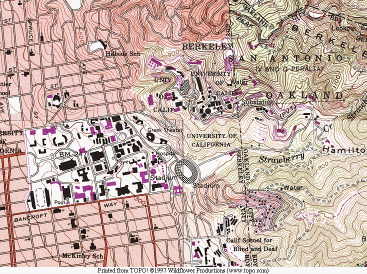
"I just discovered a cool thing which you may already know about. It is a software package that comes on 2 CD’s and the program & disks include every USGS topo map along the California coast from San Simeon to Gualala, and as far inland as Lake Berryessa to Mt. Diablo etc. These are the green maps that you use when you go hiking in the Sierras..."
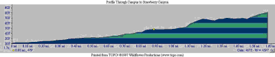
"A color or black & white plot can be done at multiple scales (7 ½ minute and 15 minute are what you mostly see in the paper versions of the map), but as you get more ‘zoomed in’, the resolution gets fairly weak. You can do a profile cut anywhere you want and see the grade changes in a special routine that the program has - like a section through the hills from my house to Calistoga. The main use I have is for site plans and site location maps for projects. The program can output into multiple formats; BMP, TIFF,GIF,JPEG,PCX..."
"I think it is an amazing product. You can Order it from REI for $49.00 + shipping."
Though you can get full 3D topographic site maps from several USGS sites, none deliver this particular type of output. This is rather impressive, especially when it is only $50.
You can check this product out for yourself @ Horizon Maps Exclusively at REI